

Satellite images – Medium Resolution (MR)
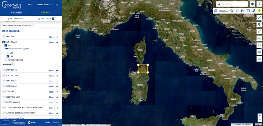
This project leverages Copernicus Sentinel-2 satellite imagery to monitor coastal and marine ecosystems at large scale.
Free, frequently updated multispectral data are used to map and track Posidonia oceanica meadows over time. By combining the full spectral information of Sentinel-2 with advanced machine learning and deep learning techniques, the project enables robust classification and long-term change detection in support of marine habitat conservation.
Aerial drones – Ultra High Resolution (UHR)
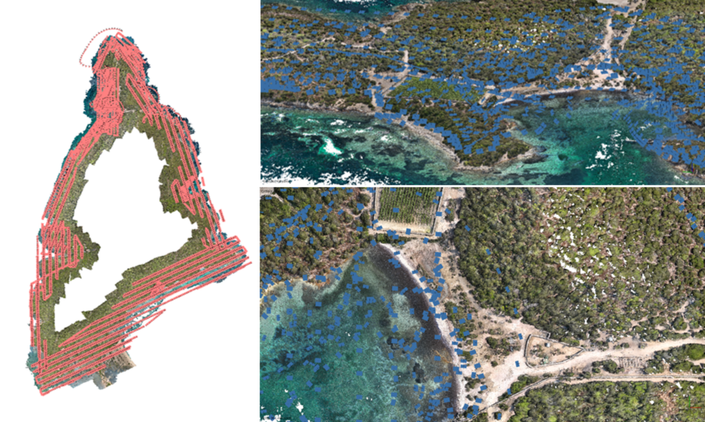
Unmanned Aerial Vehicles (UAVs) are used to monitor Posidonia oceanica banquettes through high-resolution photogrammetry.
Aerial drone surveys provide centimetric spatial resolution, enabling detailed mapping of banquette extent, morphology and spatial variability. Structure-from-Motion and Multi-View Stereo (SfM–MVS) photogrammetric workflows are applied to generate dense point clouds, orthomosaics and digital surface models, supporting accurate quantification and temporal monitoring of these coastal deposits. This approach complements satellite observations by capturing fine-scale coastal processes essential for understanding banquette dynamics and their role in coastal protection and blue carbon conservation.
Uncrewed surface vehicles – Ultra High Resolution (UHR)
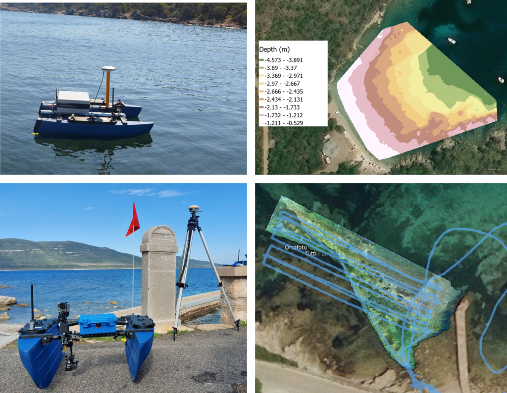
Uncrewed Surface Vehicles (USVs) are employed to acquire high-resolution bathymetric data in shallow coastal waters.
These platforms integrate acoustic sensors and optical imagery to map seabed morphology with high spatial detail. Acoustic measurements provide reliable depth information, while photogrammetric techniques support the reconstruction of very shallow and near-shore areas where traditional bathymetric surveys are limited. The use of acoustic and image-based methods enables accurate, spatially continuous bathymetric models, supporting habitat mapping and the monitoring of coastal and marine environments.
Underwater Photogrammetry – Beyond Ultra High Resolution (BUHR)
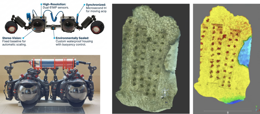
In-house developed underwater stereo photogrammetric systems are used to acquire ultra-high-resolution data on Posidonia oceanica meadows.
Stereo camera setups enable centimetric to millimetric spatial resolution, allowing detailed reconstruction of seagrass structure, canopy density and seabed complexity. Image-based underwater photogrammetry, based on calibrated stereo vision and multi-view reconstruction, supports the generation of dense point clouds and high-resolution orthomosaics in clear and shallow waters. This approach provides fine-scale information that complements remote and surface-based observations, improving the understanding and monitoring of Posidonia meadow condition and spatial variability.
Hyperspectral
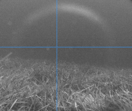
At the BUHR scale, an hyperspectral camera is proposed to carry out seagrass analysis at sub-centimeter scale, taking into account different PO health status: degraded, dead or restored (in case of transplantation site). It is the Senop Rikola, with a spectral range from 500 to 900 nm, and a spectral resolution of 1 nm. The Rikola was used underwater thanks to the waterproof case designed and built and a set of alogen lamps. The first test of the underwater system was carried out on October 2024 in Culuccia, our testbed. The preparation of the acquisition involved the creation of some sequences of wavelengths to be recorded by a memory card inserted in the camera.
Posidonia oceanica Fish Assemble – Study Areas
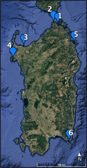
Two summer expeditions along 4 different areas of the Poseidon project were conducted by Roma 3 research group. The sites were in North, East and Southeast coast of Sardinia Island: 1. Isola di Culuccia (North coast), 2. MPA Capo Testa Punta Falcone (North coast), 5. MPA Tavolara Punta Coda Cavallo (Northeast coast), 6. MPA Capo Carbonara (Southeast coast).